Wednesday, November 13, 2013

Daytrip - Lake Chuzenji and Kegon Falls

by Mr Julie - visited October 2013


Lake Chuzenji/Kegon Falls is a scenic area maybe an hour by bus west of Nikko, which is regarded as THE JAPAN (the same as Uluru is considered THE AUSTRALIA or maybe the Grand Canyon is regarded as THE USA).

The distance in a straight line from the Mt Nantai place-marker to Nikko station is only 12km - but the road to the lake is over twice this. The windey, steep pass each side of the lake is a great scenic trip in itself.

For some reason I didn't take any pix of the winding mountain passes (maybe on account of the cloudy/misty conditions) - this is a shot early in the trip where we are still in the western outskirts of Nikko. The bus seemed timed to coincide with one of the early daytrip trains from Tokyo and our early weekday bus was absolutely packed out - many of the local area mamasans seemed used to this and handed their bags etc to passengers to nurse. You dudes may be thinking ol' Mr Julie should give his seat up for these ladies - but at my age I shade them to billy-o (last a quaint ol' Aussie term meaning "to hell and back").

Okay, I didn't take any shots - but I raided Google Earth's embedded pix fer a good one - this great pic is from Hirohuru Shizuya - Panoramio and shows the road out which for the first 5km or so is actually along a separate route to the road in. This shot doesn't show the awesome views down into the adjacent gorges but the windiness is apparent - I'd love to get my triathlon bike up here and do a down-hill fang.

First stop when we reached the lake was to take the short walk to the right (facing the road from the bus-stop in Chuzenji town) to the top of Kegon Falls. The misty conditions didn't make for great viewing, particularly here at the top of the falls, but.....

.....a quick elevator ride down to the bottom viewpoint was really good value at 530yen. Now I'm not a great fan of spending extra money, but I thought this expenditure was well worth while.

We wondered how good this place looks at times of clear visisibility. Fortunately......
.....Google images can come up with some good ones. This great January shot is from Tokyo Topia.

And this nice one shows how the falls actually drains the lake area behind - image from Japan Unveiled.
Wow, if only we had visited in weather like this.

The area adjacent the elevators at top of the falls had a bunch of touristy outlets selling souvenirs etc - not a bad place to get a coffee at a reasonable price.

From the falls back to town is maybe 5 minutes - the lakeside starts soon after the bus-stop. As seen the mist was pretty hard-core. This is the stop for the ferry lake tour - we decided to give it a miss.

Google images suggests we missed out big time - shot 銭形警部 - panoramio

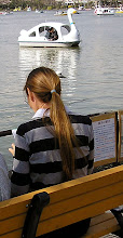
 Chuzenji Onsen is a nice little town. Quite a few hotels, inns and spas plus plenty of restaurants (click image to expand).The tourist walk along the lake-side...........

......is good value, even on misty days.

At the western end of town is a Futarasan shrine. Julie was impressed that there was no entrance charge, unlike the similarly named place and its neighbours back at the world heritage Toshogu site in northern Nikko town.
If you follow the path up through the shrine there is a gate behind which starts the trek up impressively high Mount Nantai. The sign said 6 hours return, and with the time around 1400, we gave it a miss. Nothing to do with my wrecked knees from too much jogging (wrecked knees hate going down steep slopes) or that visibility was limited at the bottom, imagine further up.

Hey, looks like it's worth climbing in good weather, wrecked knees or not. Image by M.KJ - Panoramio

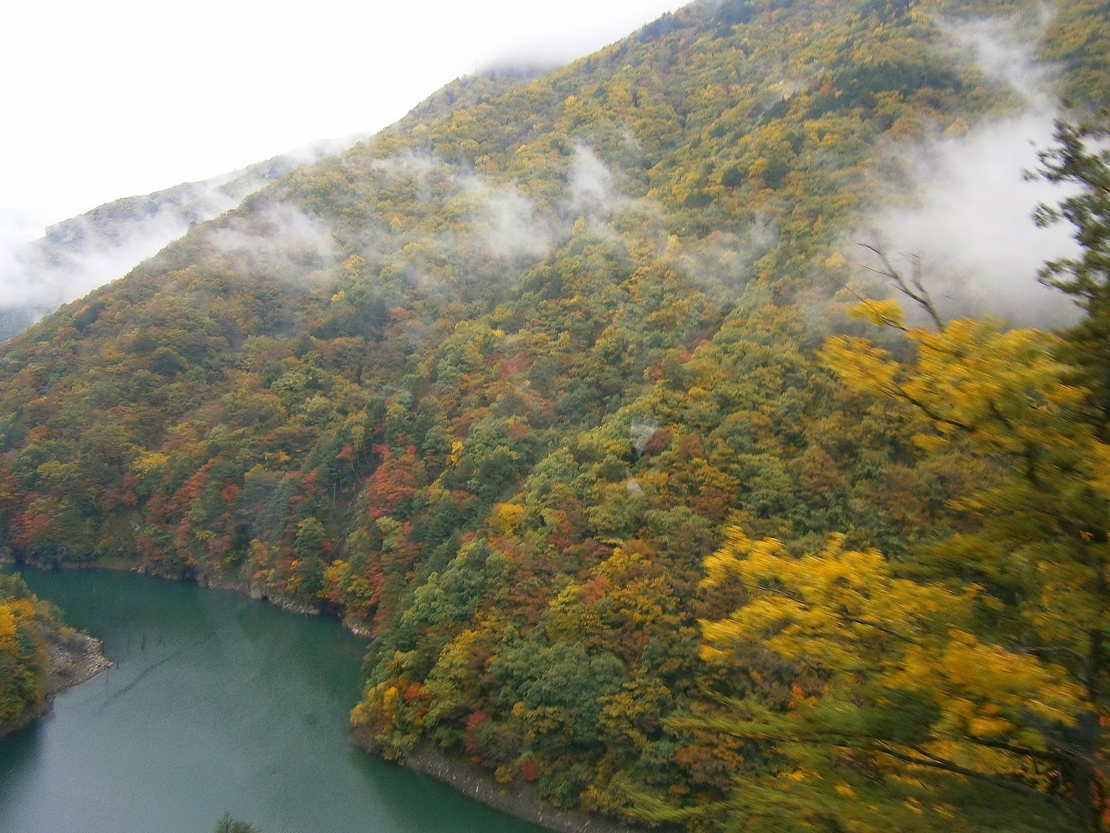
Nankai is one impressive looking mountain. Apparently an eruption way back helped create the lake. You can see Chuzenji Onsen strung along the far right side - image japan-guide.com

SUM UP: Despite the misty drizzly conditions I thoroughly enjoyed my day visiting the lake and falls. I have to admit I'd love to go in in fine weather, maybe spend a few nights up there. There is plenty on offer - a great cable car from the highest point of the access road (covered with cloud of course when we passed by in the bus), a 25km lakeside circumferential trek, other places to stay around the lake, two different lake cruises, another waterfall, temples, museums, spas and of course a walk up Mt Nantai (don't want to think about the walk down). At 1200m the lake is high enough to take the edge of Japan's hot/steamy summer weather - which explains why so many foreign embassies put weekend escapes/holiday residences up there. Yumoto Onsen is another seemingly attractive destination about 10km north west of Chuzenji Onsen.


both images from japan_guide.com


NIKKO
Nikko is a busy tourist town about 2 hours north of Tokyo. As mentioned before, it and the surrounding area are known as THE JAPAN and as such get a heck of a lot of visitors both foreign and (particularly) domestic.

Access from Tokyo is pretty simple, on the Tobu Railways line (Julie says to check if your train runs directly to Nikko or if you change trains at Shimoimaichi nearNikko . Don't ask how she knows that this is important) - or for people like us with a JR rail pass, indirectly via Utsunomiya.
Tobu can sell you a whole rash of combination rail/bus/entry tickets either at their Tokyo offices or in the big tourist information center at their Nikko station. We took advantage at the latter with their 2 day bus pass (2000 yen each) which allowed us to save considerably on several trips the few km north to the Toshogu shrine/Kanmangufuchi Abyss areas and to the wonderful Lake Chuzenji/Kegon Falls.

This is more the less the heart of town - the "town square". The bus-stop shelters are central left and the high-roofed Tobu railways tourist information center top right. The Tobu platforms are immediately behind - the JR station is 250m to the right of frame. There is a string of businesses around the square with quite a few good value budget restaurants. This was shot from the top of our hotel, the Nikko Park Lodge Tobu Station.
I thought this joint pretty good with a comfy not too small room, quiet (front rooms close to the square may be noisier), reasonable value, a sizable budget Lion-D'Or supermarket about 3 minutes behind camera and of course quick access to the trains and buses. However I notice Julie's user review on the booking website didn't rate too highly - I think she was unimpressed by no-one seeming to be around on book-in and check-out. But we booked-in and checked-out okay, so who's worrying? (image Agoda Nikko Park Lodge)


The world-heritage Toshogu shrine area is polarizing - some think it's the bee's knees, other culture-deficits like me are maybe interested in walking around outside but are not too whelmed about the whole thing, particularly paying big money to go inside. And true connoisseurs of Japanese heritage are not impressed by the over the top/ornate nature of many of these buildings. Apparently ol' Iemitsu of the 3rd Tokugawa shogunate who built much of this area in the early 1600s was a mug lair (Aussie for ostentatious show-off). One thing's for sure - present day Japanese think it's worth a look. The area was pretty crowded on a Monday of very dodgy weather.
Julie was disappointed. Apparently this attraction had reasonable entry charges for each place when she first visited in the '90s - she thought 2013's entry fees a real gouge. Additionally the particular Tobu Railways World Heritage Pass which included entry into these buildings was not available at the time - apparently the attractions could not agree on the distribution of funds. So we checked the outsides only. 
A good point: access from the station area is easy - it's less than 2km or 5 minutes in the frequent buses (most of which have a final destinations of Lake Chuzenji or further) or a half hour walk  thru an interesting mountain town streetscape (turn right up the main road hill from the station square, turn left at the famous Red Bridge - slopes lower-moderate, even the unfit will have no problem).

The Red Bridge (correct name Shinkyo Bridge) was the original entry to the Toshogu area - 300yen allows you to walk on it. We didn't bother - shot this from the bus.

The Toshogu world heritage area is not a bad place to wander for 60 minutes or so, but for me not half as good as the following 40 minutes when we........

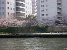
.......strolled thru the Kanmangafuchi Abyss area. This is a short distance to the west and down from the opposite side of the main road once leaving the Toshogu world heritage area. Abyss may be a bit strong - it's not exactly a grand canyon type area - but the rapidly flowing whitewater through the narrow valley area was relaxing and attractive. As usual there were cultural attractions - some old temples and about 70 carved stone......
......Bake-jizos which are rumoured to change position between your visits. Crikey!

Our autumn visit saw moderate water flow. This place would probably be really something in spring when the river is swollen by meltwater.

SUM UP: Like at  Chuzenji, we only scratched the surface in Nikko town. There is a lot more to do - we didn't go anywhere near the Kirifuri Heights or Kinugawa areas. The latter has onsens and theme parks plus a wide range of accommodation. The former has hiking trails in summer and skiing in winter. On that subject, Google Earth shows a number of ski areas more or less adjacent to Nikko town. The Kirifuri Heights is only a half hour by bus from the station.

Please note that comments are welcome, but we do not check the blog regularly enough to answer questions. Please post your questions on Lonely Planet Thorntree, where you will get the benefit of other posters' wisdom. Alternatively you could post your question on my island and beaches blog forum  which gets looked at most days.


Thursday, November 7, 2013

Daytrip - Kamikochi out of Matsumoto

by Mr Julie - visited in October 2013


Kamikochi is a high mountain valley area in the Hida Mountains of central-northern Honshu. It has spectacular scenery, pleasant walks and a number of conventional hotels and traditional ryokan style inns. Even a couple of camping grounds. The area has a number of spa locations. Winters are pretty tough here which sees the area closed from mid November to mid-late April. This place is very popular - apparently summer and autumn weekends plus school holidays can see 2 hour traffic jams on the access road north of Shin-shimashina. Our weekday visit in late October saw no traffic problems although there must have been a couple of dozen big tourist coaches parked at the visiting area. Our train (past the university) and bus had room to spare.

The nearest city is Matsumoto (far right) from where we did Kamikochi as a day-trip. Straight line distance is about 30km but the combined rail trip (30minutes) and bus trip (60minutes) is considerably further. It is possible to catch a bus from the central Matsumoto bus station opposite the railway station, but there is only one per day. It is also possible to drive much of the way, with several parking stations along the road before the entrance to the national park. Private cars and motorcycles are not allowed into the national park area. For 40 of the busiest days even the private tourist coaches are banned from entering. You can pick up shuttle buses like ours and taxis from the parking areas.
It is also possible to come from lovely Takayama to the west by both car and bus.

Relative position of Matsumoto. I missed the nearby city of Nagano which is in the cleared area just north of the Mat for Matsumoto.

Our Dentetsu Railways train from Matsumoto arrives at Shin-shimashima railway station. These run about every 45 minutes and the following buses are waiting in the parking area. The combined train-bus ticket at $us40 return (J R rail passes don't work on this line) is not cheap but the scenery on the bus section alone is worth it. The scenery for half the train trip is not bad either - one of the campuses of Matsumoto's Shinshu university is about half way along, and the train to there was crowded with cute co-eds.


From Shin-shimashima the road winds its way up the narrow Azusa river valley with steep drops to white-water streams, soaring mountains (lots of low cloud our trip unfortunately), frequent tunnels, several mountain villages and a few dams. When the bus reaches the limited access road into the national park the pavement narrows markedly leading to intricate passing maneuvers.

The autumn leaves of red and yellow....

The road terminates at the the Kamikochi bus station. Tourist orientated businesses include a bunch of eats places, souvenirs, an information office, post office, taxi office, a police station, luggage office and a bus ticket office. In busy times people are urged to reserve a seat (no charge) on arrival for one of the returning shuttle buses. Not wanting to be restricted to a definite departure time we didn't bother - the relatively small crowds saw our bus about a third full on departure, and less than half this by Shin-shimashima after dropping people at car parks, hotels and spas along the way.
The wc's by the visitors' center asked a 100yen donation, something neither of us have previously seen in a "public" area in Japan.
A good few of the hotels are within easy walking distance of this bus arrival area.

The riverside*walking paths are too long to do in one day unless you are staying in the area and start really early. Nearly 6 hours of our time was taken with bus and train travel so we confined ourselves to the most popular area below Kappa Bridge top right of image (not far from the bus terminal) down to Taisho Pond bottom left. It is possible to walk both sides of the river for part of this "circuit" and to take a separate "forest trail" (site of the "track back" place-marker mid-left)  for some of the return in the southern section. We spent a bit over 3 hours doing the total route - following the blue "track out" route down to Taisho Pond and the off-white "track back" path back to the terminal. We noticed a lot of the tour buses were dropping their passengers at Taisho Pond in the south and meeting them at the bus terminal. The walk up-stream involves only gentle gradients. Most groups tended to walk up the eastern (right-hand) side of the river.
* there are a number of side tracks which lead up into the highlands for the really keen.
There is a really good map with lots of detail of the whole area Tashiro Pond to Yooko at the end of this section.

From the bus terminal we headed directly for the Kappa Bridge only 5 minutes north. A bunch of eats places and similar tourist outlets were on the other side. The area's major camping area is this side in those trees past the bridge. 4 of our route's 9 hotels start a bit inland along the far side not too much distance from the bridge in the down-stream direction. They are spread out along a good 400m.

This dude was feeding his face about half way between the two bridges on the western side.

We crossed back to the eastern side of the river at the Tashiro Bridge. Low clouds lifted a bit to expose Mt Mae-Hotakadake - at 3090m one of the highest in the area. The slightly higher Mt Oku-Hotakadake is obscured to the left. Average river height is 1500m. I have seen a pic of this area in spring on a cloud-free day. The snow covered peaks sure looked good. 

A bit further south along a short side path is the Tashiro Marsh or Pond. The eastern valley slopes are closer, nearly as high and more precipitous than the western side in the previous shout. 

Our southern turn-around was at the Taisho Pond. The active volcano Mt Yakadake (output is steam only in present times) is hidden in the clouds behind. Debris from an eruption in 1915 dammed the river to form the pond.

I couldn't resist pulling this great shot of Mt Yakadake from Google Earth's embedded pix. Image Panoramio - K Yato 

The path north of the Tashiro bridge on the way back to the bus terminal had more fine river and mountain scenery. South of the bridge we took a more easterly "Forest Trail" which parallels the riverside track - this was more noted for its boardwalk sections over marshy areas than the trees. 

With an average gap between shuttles to Shin-shimashima at 45 minutes we didn't have too long to wait at the bus terminal. A boarding pass with allocated seats is required so if you haven't done this on arrival make sure you call at the ticket office before departure.


Back on the bus....


Back on the train......

This excellent map from JAPAN ALPS KAMIKOCHI shows the complete area, not just the southern section we did, and has much more detail like hotel locations. Like all pix on this page it can be click expanded for detail but a much bigger version can be seen by clicking to the website here.


MATSUMOTO


Matsumoto with about 240000 people is a basin city surrounded by mountains in the Nagano prefecture of the central northeren highlands of Honshu. It is a gateway to the surrounding mountain regions including several good ski areas, the Kamikochi area detailed above, the Norikura highlands (trekking, camping, skiing, spas, nature) - and has the oldest non-rebuilt castle in Japan. Matsumoto also has lots of museums and is a center of arts, particularly music. At a little over 600m altitude it has a mild summer climate and quite cool winters. 
Access is good - the JR Azusa limited express from Tokyo's Shinjuku station takes 2.5 hours and a JR bullet from Tokyo central station to Nagano to the north (1.5 hrs) followed by the JR Shinano limited express (50mins) may work out around the same total time depending on connections. We came in from Nikko in the mountains north of Tokyo on a 4 train medley Nikko via Omiya and Nagano in around 4 hrs. We exited Matsumoto on the Azusa limited express to Shinjuku. People travelling from places like Hiroshima, Osaka and Kyoto can catch a bullet to Nagoya on the main southern line and then the Shinano limited express (2hr). Drivers can use the Chuo express from Tokyo or Nagoya. Matsumoto has an airport with connections to Fukuoka (Kyushu) and Sapporo (Hokkaido).

The heart of Matsumoto is the railway station which is adjoined by a big department store on the east (left). The eastern exit of the station runs by this and descends to a sizable square with local buses and taxis. The unassuming CBD starts to the east of this square. The long-distance bus station is across the road from the square to the south-east (the camera here is looking south-east from our hotel on the other side of the station). There is a host of reasonably priced restaurants within a short distance of the station - the various department stores have a floor of restaurants and the Ario Dept store adjacent the bus station has a budget-priced supermarket in the basement for milk, fruit, bakery stuff etc. I loved the cheap beer and wine.


Matsumoto Castle is a genuine original wooden castle, the oldest in Japan. Any castle claiming to be older has been rebuilt from the rubble of war, earthquake or fire. Admittedly, sections of the above castle have been restored but it has never been destroyed. It is an easy walk from the station - head east from station square for 2 traffic lights, turn left and walk 10 minutes. 15 minutes in total and well signposted both in Japanese and English scripts.
Admission was 600 yen each which also gained entry to the smallish separate museum in the grounds (well worth a look - and I'm not big on museums). The interior of the castle is dark polished wood and steep staircases - there are some well documented and comprehensive displays of weapons, samurai armour etc.

This dude seemed to spend all day posing for pix with visitors - no charge. He positioned himself in the area of the previous shot so it was possible to have the castle as a back-drop. Another free service was local English-speaking volunteer guides if required. We didn't want to be tied down time wise - besides which the castle has good dual language information boards like most touristy places in Japan.

A short distance on the return to railway square from the castle is Nakamachi - an area of restored Kura storehouses and shops - now used as restaurants, craft houses, small museums and souvenir shops. There are many other places in town with similar activities, but maybe not as concentrated.

Our digs in Matsumoto from the Dentetsu Railways (Kamikochi) platform: the grey Hotel Montagne - take the western station exit and walk north along the road adjacent the railway for 3 minutes. Inexpensive (mid $us80s), quiet, clean, room a tiny bit bigger than the average compact Japanese lower-midrange place, the usual impeccable service.

Please note that comments are welcome, but we do not check the blog regularly enough to answer questions. Please post your questions on Lonely Planet Thorntree, where you will get the benefit of other posters' wisdom. Alternatively you could post your question on my island and beaches blog forum  which gets looked at most days.